|
ISLANDS of Washington Blvd Tour
10.11.09
Over 60 artists reinterpret public space along entirety of Wash Blvd
WHERE: The entire length of Washington Blvd., from Whittier to Venice Beach
WHEN: October 11, 2009 10AM-6PM
MEETUP: 10:00 AM PERSHING SQUARE
ROLL TIME: 10:30AM SHARP
DISCUSS: Here
ADDITIONAL INFO: Here
60 MILE ROUTE: Map
CONTACT NUMBER: 56 to 67 tree 06 for tree
The map and listing below are from Islands Anyone?, a project by Islands of LA for the Washington Blvd Art Concert that invites everyone to visit traffic islands along Washington Blvd. The map below is of all the traffic islands on Washington Blvd where groups ranging in size from ~5 – 30 people, depending on the island, can gather and engage in expressive conduct at any time without a fee or permit.
Locations by intersection, listed from West to East:
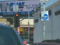
Fairax Blvd: SE, SW, N – the SW island is one of the largest islands on Washington Blvd and the only one that has parking
Apple St: freeway offramp and border between Culver City and Mid-City
Hauser Blvd: this island has a bus stop
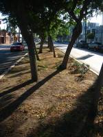
Pickford St: these islands are landscaped and perfect for those seeking an idealized, miniaturized nature hike/scenery experience
West Blvd: this island as a bus stop
La Salle Ave: this island is across the street from a check cashing store with a pair of female mannequins provocatively gesturing towards each other
Normandie Ave: the second largest island, this is actually a peninsula, and it has the most pedestrian traffic of the islands on Washington Blvd, it also has a bus stop
S Flower: the street level satellite image of this island appears to show a person on the ground, with another bent over them
E 23rd St: a lovely, triangular concrete island where you can enjoy some sun in an industrial area of downtown
Industrial Way: a triangular concrete island in an industrial area of southern Boyle Heights
S Grand Vista: a narrow median too small for assembly but with a look-out point for those willing to traverse a most narrow path
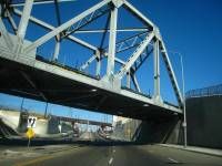
5 Freeway: West of southbound offramp, between southbound offramp & 5 freeway, between southbound onramp and 5 freeway
605 Freeway: very large islands between onramp and offramp, between onramp and freeway
Whittier Blvd: NW, N, S – This is one end of Washington Blvd where it turns into Whittier Blvd. These are large islands. There are a couple other small islands here, some are at the intersection but along Whittier Blvd. The island to the north of Washington Blvd is not accessible from Washington Blvd. You have to follow it down Whittier to the intersection of Whittier Blvd and Pacific Pl.
Slideshow
Washington Blvd through the lens of its traffic islands suitable for public assembly – a slideshow view of Washington Blvd through the lens of traffic islands. Most of the islands in the slideshow are suitable for public assembly and included in the map above. Length of slideshow is 6:30 minutes.
|
|
|
 -->
-->
 Ridazz Roulette!
Midnight Ridazz(tm), Ridazz(tm) and Skull(tm) Reproduction without written permission prohibited.